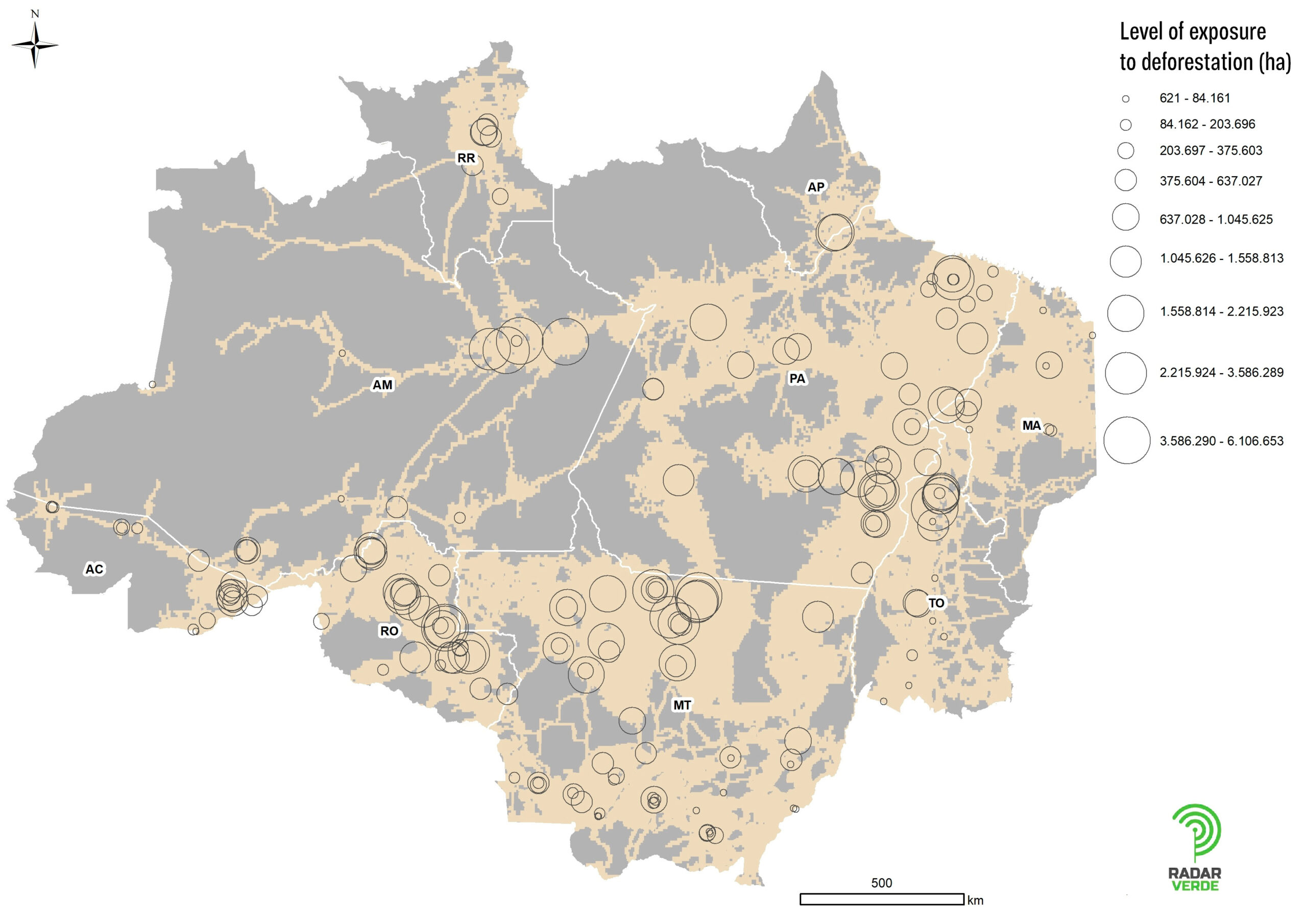
Figure 5 illustrates the locations of slaughterhouses operating in the Legal Amazon, highlighting their cattle purchasing zones and the associated levels of deforestation risk. The map reveals the areas where livestock farming may exert the greatest pressure on forests, helping to identify priority regions for monitoring, traceability, and responsible purchasing policies.
Figure 5. Location of slaughterhouses in the Amazon, the potential cattle purchasing zone, and the Level of Exposure to Deforestation Risk

Map created by: Arthur Rocha for Imazon, 2024.


